Flood Consequence Assessment - Wales
In Wales the requirements for a Flood Consequence Assessment are set out in the Planning Policy Wales Technical Advice Note 15: Development and Flood Risk (TAN 15) July 2004 which sets out the Welsh Assembly Government policies on different aspects of land use planning in Wales.
A Flood Consequence Assessment report is required for developments in flood zones C1 and C2. For flood zone B, site levels need to be checked against extreme flood outline levels which are provided by Natural Resources Wales, initially through their website and possibly through further consultation.
TAN 15 Development and Flood Risk Development Advice Maps have been produced by the Welsh Government, and are available online by clicking here, enter the site location or postcode and the map will display if the site is in a relevant zone and if so what zone is applicable.
TAN15 requires the level of detail of the Flood Consequence Assessment to be proportionate to the scale and nature of any development.
Natural Resources Wales, a body formed by the Welsh Government, took over the functions previously carried out by the Environment Agency in Wales.
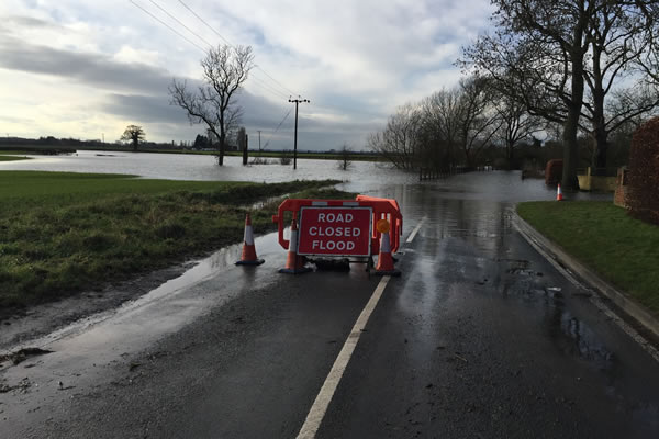
The Welsh Flood Zones have been produced using a flood model known as JFLOW. JFLOW has been used to produce the 1% (1 in 100 year) and 0.1% (1 in 1000 year) flood outlines. The Environment Agency acknowledges that the JFLOW method is generalised and does not take flood defences into consideration. As such, the flood outlines produced by JFLOW can only be taken as a rough guide, showing where more detailed flood risk assessments are required.
Sanderson Associates has all the expertise and experience needed to challenge and in some cases correct the Natural Resources Wales flood maps should there be any doubt as to the flood zone allocation for a particular site. Flood zone correction often requires detailed flood modelling. We would usually recommend that a Desktop Flood Risk Assessment is first carried out in order for us to assess what type of modelling will be required and how much it will cost. Further information can be found on our flood modelling page. Sanderson Associates regularly construct flood models to estimate anticipated flood levels directly using relevant software and data sets.
We have extensive experience of completing Flood Consequence Assessments which are fully compliant with Technical Advice Note 15: Development and Flood Risk (TAN15) July 2004, we offer three levels of Flood Consequence Assessment in line with TAN 15, call us on 01924 844080 or complete our secure on line form to obtain our competitive quotation.
Flood Consequence Assessment Level 1 – Screening Study
This report will provide a general indication of the potential flood risk to the site and identify whether there are any flooding or surface water management issues that may warrant further consideration or may affect the feasibility of a development. The purpose of a Level 1 Screening Study is to ascertain all sources of flood risk and whether any further work in the form of a Level 2 Flood Consequence Assessment (Scoping Study) or Level 3 Flood Consequence Assessment (Detailed Study) is required. It may also confirm that the site is at low risk of flooding from all sources. Our report will also define what ‘Zone Classification’ the proposed site falls under and confirmation if any further assessment is required to be undertaken.
Flood Consequence Assessment Level 2 – Scoping Study:
This report will provide qualitative appraisal of flood risk posed to site and potential impacts development will have on flood risk elsewhere. Production of Flood Consequence Assessment Scoping Study Report including possible measures to reduce flood risk for submission to Natural Resources Wales for comment / approval, all in accordance with TAN15 July 2004.
Flood Consequence Assessment Level 3 – Detailed Study:
A level 3 Flood Consequence Assessment would be undertaken if Natural Resources Wales required further quantitative analysis to assess flood risk issues relating to the proposed development site e.g. Catchment Analysis, Hydraulic calculations or Flood Modelling may be required (if flood levels are not already available).
Production of a detailed Flood Consequence Assessment may include catchment analysis, hydraulic calculations and modelling to quantify the potential flood risk to the site along with off-site flood risk impacts such as displacement of flood waters due to development and determine appropriate flood risk mitigation measures.
Require a Flood Risk Assessment?
Sanderson Associates have enjoyed over 37 years in business, our Flood Risk Team have extensive experience completing Flood Risk Assessments in support of our clients major and minor developments throughout the whole of the UK.
We would be pleased to provide you with our competitive fee proposal for a Flood Risk or Flood Consequence Assessment, please call us on 01924 844080 or click here to complete our secure online form.