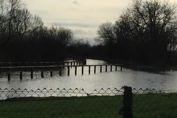
Flood Risk Assessment
Flooding is a natural process which cannot be prevented entirely, but it can be managed to reduce its social and economic consequences and to safeguard the continued functioning of services and infrastructure. Some locations are already susceptible to intermittent flooding and climate change is expected to worsen the situation. Inadequate drainage infrastructure also increases the risk of flooding.
Planning Authorities must take the probability of flooding from all sources – (coastal, fluvial [water course], pluvial [surface water], groundwater, sewers and blocked culverts) and the risks involved into account when preparing development plans and determining planning applications. This does not mean that developments or redevelopments in these affected areas will not be approved, the planning process is there to ensure flooding is materially taken into account in development proposals.
As part of the planning process a Flood Risk Assessment, or a Flood Consequence Assessment in Wales, ensures that developers are aware of the requirements of the Environment Agency in England, Natural Resources Wales in Wales or the Scottish Environment Protection Agency in Scotland and specify mitigation measures to ensure that a development is sustainable and safe in terms of flood risk or flood consequence.
From property extensions, works to large employment, residential and office developments, Sanderson Associates have vast experience in providing bespoke, site specific Flood Risk Assessments and Flood Consequence Assessments [Wales] for new developments and also existing facilities.
The Planning Process
At every stage of the planning process, we provide our Clients with valuable advice and guidance on flood resilient design so as to reduce the impact of flooding. We have an excellent working relationship with the Environment Agency, Natural Resources Wales and the Scottish Environment Protection Agency and work collaboratively to facilitate the development of sound and sustainable buildings in compliance with the National Planning Policy Framework; TAN 15 (Wales) and SPP (Scotland) Scottish Planning Policy all of which currently regulate new development in areas of flood risk.
Whether it is an extension, new dwelling or major residential, retail or employment development, we can provide the necessary assessment to go with your planning application. Our wide client base includes Hospital Trusts, Fire Authorities, Councils, major Supermarket chains, Architects and housing developers through to smaller private developers and domestic Clients.
Business Continuity
We also provide site specific flood risk assessments for existing business and domestic premises where current facilities face the risk of flooding from any source and can provide a comprehensive report on risk to property.
Our assessments include a full breakdown of mitigation measures to reduce flood risk and we provide assistance to Clients in designing and sourcing the most cost effective ways of protecting their development, business or home. We continually work to facilitate and expedite the planning process as much as possible for all our Clients.
What Our Clients Say:
Swept Path Analysis and Visibility Drawing incorporated into a Technical Note, Proposed Residential Dwelling, Colchester.
Highway Statement, Proposed Residential Development, Stockport
Transport Assessment, Proposed Residential Development (170 dwellings), Essex
Speed Survey, Proposed Private Residential Development – Testimonial
Access Feasibility Study, Proposed Private Residential Development – Testimonial
Analysis of Speed Survey and Swept Path Analysis
Stage 2 Road Safety Audit, Residential, Staffordshire
Construction Traffic Management Plan
Flood Risk Assessment, Testimonial, Industrial Development, Sheffield
Travel Plan
Require a Flood Risk Assessment?
Sanderson Associates have enjoyed over 37 years in business, our Flood Risk Team have extensive experience completing Flood Risk Assessments in support of our clients major and minor developments throughout the whole of the UK.
We would be pleased to provide you with our competitive fee proposal for a Flood Risk or Flood Consequence Assessment, please call us on 01924 844080 or click here to complete our secure online form.